Eastern Sierra 56 Hour Offroad Overland Trip
How many recoveries can you fit into a Sunday afternoon? If you were with us for the Rigs and Coffee Eastern Sierra trip in February 2020, you’d know that the answer is ten.
Some of the links on this page may be affiliate links.
It was a cold winter weekend, filled with snow and rain, which was a great way to demonstrate winter camping techniques, hands on recovery training, and perseverance. From start to finish, we were gone for only 56 hours but what a wild ride it was.
Day 1
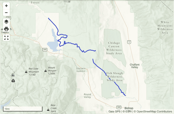
The first day of the trip we left Los Angeles, California around 6pm. Many of us elbowed our way through the parking lot on the 405 and 14 freeways until we broke free and got to the Mohave desert. Eventually, we met up as a group and had late night tacos in Lone Pine. Once we hit the trail we realized we needed to air down and pull out the MaxTrax due to the icy and narrow tail. We navigated some frozen water crossings, snowy narrow mountain trails, and downed trees. Although we weren’t able to get as far as originally planned, we finally found a level place to park our eight rigs for camp Friday night.

Day 2
On Saturday morning, we woke up to find an incredible view of the valley; white mountains on the other side of the 395 and the Sierra mountains looming above us. As the snow started to fall and the clouds rolled in we packed up quickly and headed down the mountain to Bishop to meet with the rest of our convoy. After some got much needed coffee and breakfast at Looney Bean, we picked up the rest of our convoy and headed north up Hwy 6.

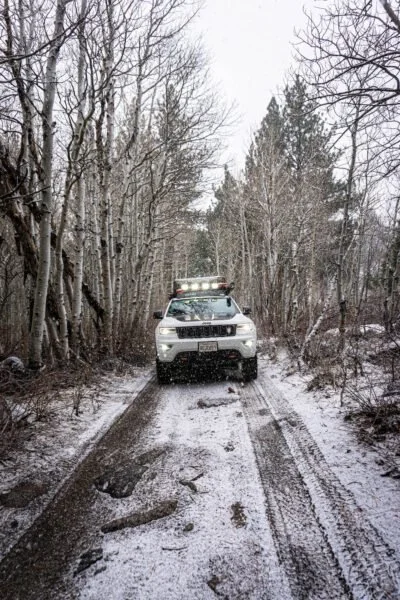
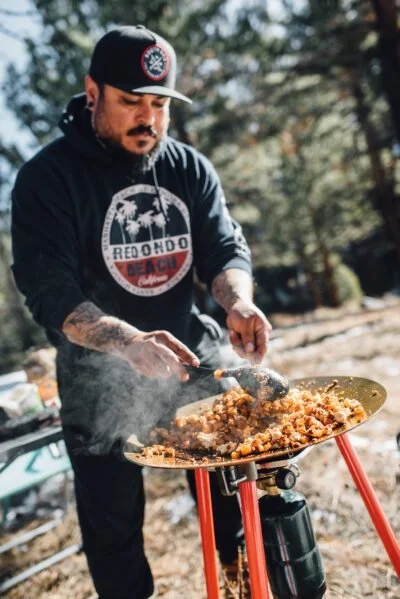
It didn’t take long until we took a left onto a dirt road. This marked the last paved road for the entire day. We found ourselves on narrow and rarely used trails winding up and down the mountains until we summited Casa Diablo. Once we caught our breath at the top, we took in the breathtaking view and had a quick snack before heading back down and finding our way to the backside of Lake Crowley for a late lunch. The dogs were able to run while we all made some warm food to get our energy back. Then, we headed away from the lake and up trails to the 395. As night fell, we hopped back on the highway briefly before arriving at our turn. We took a backcountry road to a trail that was covered in snow to the bank of a river. This was our snow-covered camp for the night. Around our homemade fire pit, we had food, good conversation, and a cold night sleep.

Day 3
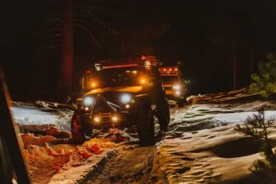
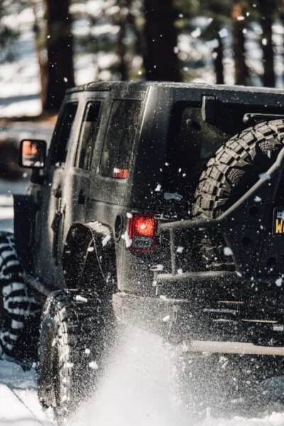
The next morning, we took it easy enjoying breakfast, coffee, conversation and warmth. Around noon we headed out on some narrow trails between the trees. We climbed a lot in elevation and quickly encountered deep snow and our first major recovery of the day. After the first vehicle got buried, the team quickly pulled out the MaxTrax and got to work. Then we headed way down the trail and found an abandon Subaru buried in the snow. This served as a reminder to always travel as a group, bring plenty of recovery gear, and know the conditions of the area you plan to venture into. Our fully built rigs, one of which ran 40s with 5.5” lift, could have crushed the Subaru into a self-made bridge, but yet we quickly found ourselves in the same predicament as the abandoned car—sunk into the snow down to the frame.
The snow had an icy top and powdered bottom making the conditions tricky. One by one, hour by hour, as a team we were able to get all the vehicles through using MaxTrax, shovels, winches, and tow straps. After heading down the trail a bit longer we entered a section that was down a steep slope with significantly more snow. It didn’t take us long to get multiple vehicles stuck. As the sun started to set, we struggled to dig out the vehicles. 200 hundred feet of recovery straps, and a ripped pair of jeans later, we were nowhere closer to making it out. It wasn’t until after dark, with the help of everyone, that we finally got everyone back to where we were two hours prior—and not yet up the steep hill we spent most of our day digging our way down.
One by one, we gained speed on the dirt, before drifting around the corner to carry momentum up the hill, all while avoiding the steep ledge on one side, and the abandoned Subaru on the other. Cheers rang out across the radio as we each successfully made it to the top.

After a quick air up, we hopped on the highway for our five hour drive back home. While we didn’t make it to Copper Top for dinner, we did make home by 2am Monday, just in time to get up for work. It was 56 hours of pure adventure.